County under Winter Storm Watch
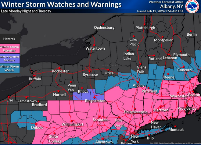
— Map from National Weather Service
A Winter Storm Watch has been issued by the National Weather Service for Albany County for late Monday night and Tuesday.
ALBANY COUNTY — Snow is expected to fall in Albany County on Monday night, continuing through Tuesday morning, tapering off in the afternoon, according to the National Weather Service.
“The expected track of this system has trended south but still remains uncertain and continues to result in a large difference between the ‘low end’ and ‘high end’ snowfall forecasts,” with Albany County expected to get 4 to 6 inches of snow, the weather service says.
Amounts have been lowered from original predictions across the Capital Region, central Mohawk Valley, and southern Vermont, but there still remains uncertainty on just how far north and west the axis of heaviest snow will extend; this is why the Winter Storm Watch remained in place on Monday afternoon.
Heaviest snowfall is expected Tuesday morning with snowfall rates of 1 to 2 inches per hour where the band of heaviest snowfall sets up.
The Tuesday morning commute will be impacted, the National Weather Service said, and the combination of snow load and gusty winds could lead to some downed tree limbs onto power lines resulting in some power outages in the wake of the storm. Stronger winds are expected on Wednesday.
New Yorkers are encouraged by the govern'rs office to sign up for emergency alerts by subscribing to NY Alert at alert.ny.gov, a free service providing critical emergency information to your cell phone or computer. For a complete listing of weather alerts and forecasts, visit the National Weather Service website at alerts.weather.gov.