Ballston Lake: A river ran through it

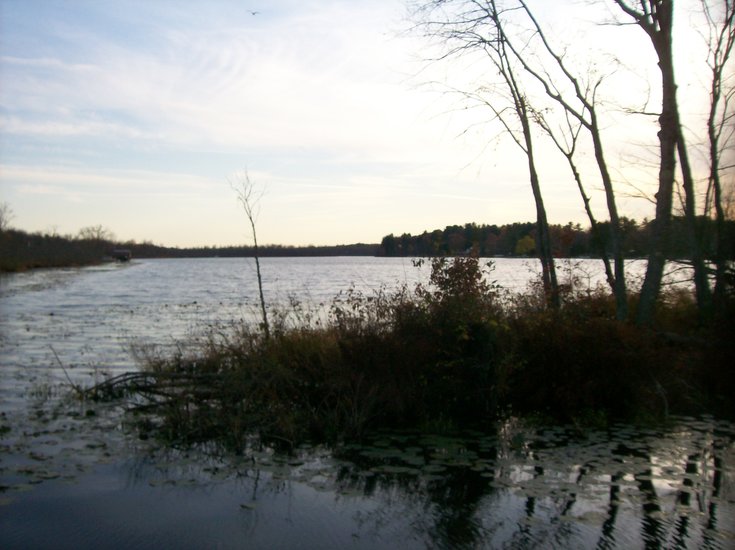
Standing on the shore halfway down the length of Ballston Lake with a young research assistant named Devin Delevan, I suppose I could be forgiven for mistaking the lake for a river: It is obviously a great deal longer than it is wide, though it shows little of the bending that any proper river should exhibit as it follows the lay of the landscape.
The false impression is quickly dispelled with a glance at a map of the region, for it can easily be seen that the lake lies in a narrow valley, fed mainly by local runoff and some small feeder streams, and empties into the rather unimpressive Ballston Brook as its waters make their way via Round Lake to the Hudson River.
Long, narrow, straight lakes are common in areas that once lay under glaciers. Throughout the Adirondacks, melting glaciers left water in fault valleys called “grabens” that are partially dammed up by the glacial sediment known as moraine. The Ausable Lakes, the Cascade Lakes, and Lake George are impressive examples.
But Ballston Lake has a different history. Thousands of years ago, highly energetic waters of the ancient Mohawk River flowed through the valley now occupied by Ballston Lake. But the river abandoned the valley, leaving the quiet lake as a reminder of how the melting Continental glacier altered the landscape of New York State.
Envisioning the ancient past
In nearly every geology course I have taken, students have been told by the professor that to truly understand historical geology one must have a good imagination: To envision, for example, this part of North America during the Devonian period, 400 million years ago, when it lay under a warm, shallow sea; or during the Mesozoic Era when dinosaurs roamed the lands that would become New York and New England, leaving their bones in sediments-turned-to-rock that have almost entirely been eroded away, except for a few places such as the Connecticut River valley; or the end of the Great Ice Age, some 15,000 years ago, when the northern parts of New York State still lay deeply buried under the steadily retreating edge of the Continental ice sheet.
But, at that time, the whole upper half of the country was coming out of the last great advance of the ice, leaving much of the Midwest flowing with rivers and streams from the melting glacier, many of them now shrunken or vanished entirely. A map of the Midwest then would look very different from the way it looks now, for the present Great Lakes had not yet formed.
Instead, the basin in which Lake Ontario sits was occupied by a much larger body of water that geologists call Lake Iroquois, which derived some of its water from proto-Lake Erie and from a huge lake farther west known to geologists as Lake Alqonquin, which would eventually evolve into Lake Huron.
Today, the Great Lakes drain into Lake Ontario via Lake Erie — and Niagara Falls — and thence into the St. Lawrence River en route to the Atlantic Ocean. But, in those ancient times, what would eventually be known as the St. Lawrence River Valley was under a mile or more of ice, and the massive Continental glacier blocked melt water from flowing directly to the ocean.
Hence, the water found its way through the ancient form of today’s Mohawk River, a river vastly more voluminous and powerful than its relatively placid modern descendant.
Today the Mohawk’s source is considered to be Lewis County, but, around 13,500 years ago, it carried the waters of Lake Iroquois, which seems to have undergone what geologists call “catastrophic” drainage. This likely was caused by the rupture of an extensive ice dam, and the turbulent flood waters cut a broad valley across the middle of New York State.
The steep cliffs that tower over the Mohawk west of Amsterdam and the wide, deep potholes that are cut into the bedrock of its banks in many places testify to the volume and power of its surging waters. And the Mohawk today — along with many other streams scattered across the northern part of the continental United States — is classified as an “under-fit” stream, meaning, simply, that it is but a remnant of its former identity as a voluminous, highly erosive river.
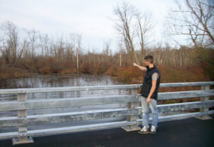
Evidence of this fact is easily visible to motorists on the Northway. About a mile south of Exit 12, drivers pass through a broad, deep valley that stretches east toward the Hudson River and west toward Ballston Lake. On its north side are visible once-rugged cliffs that are now softened by years of erosion and tree growth. At the bottom of the valley flows only the gentle Ballston Brook, offering barely a hint of the great and powerful flow that once cut down through the bedrock.
Where did the river go?
But this scene triggers the question: Where did the river go and why did it go there?
The answer, as with many geologic questions, lies in the distant past. As the Continental glacier retreated from New York State nearly 15,000 years ago, the Hudson River Valley — which carried an enormous volume of the glacial melt water — became blocked somewhere near Newburgh.
The blockage was presumably made of moraine and it formed a gigantic natural dam. Its effect was to create to its north an extensive body of water known to geologists as Glacial Lake Albany. The lake stretched at least as far north as Glens Falls, and probably resembled Lake George and Lake Champlain, both of which were left by the retreating glaciers.
To the north of the natural dam, the east and west sides of the Hudson Valley have fairly steep profiles until the Albany area is reached, which kept the lake relatively confined and narrow. But, at Albany, the west side becomes a broad, gentle upward slope, and so the lake was at its widest in the Albany-Schenectady-Troy area, stretching east on a line that probably closely followed today’s Route 4 — only a couple of miles from the river — but west as far as Schenectady.
This meant that the Mohawk River — which at that time was carrying massive volumes of water and sediment from western New York State and the proto-Great Lakes — did not become a tributary of the swiftly flowing Hudson as it is today above Cohoes but was a standing body of water. And, when rivers do this, they slow down and begin to deposit their massive loads of sediment. The result is the development of a delta.
For examples, think of the Mississippi Delta or the delta of the Nile River. The Pine Bush of Albany County formed, and numerous sandy pine barrens to the north of Albany along today’s Hudson River show the presence of other, smaller interlocking deltas as well.
Within deltas, rivers break up into what are called “distributaries” — networks of lacy, interwoven smaller streams and perhaps two or more larger ones. Given the vagaries of seasonal changes in the volume of water and sediment being transported, these distributaries are subject to sudden, rapid changes in their paths.
At some point in the distant past, a distributary of the ancient Mohawk found its way into the valley that today holds Ballston Lake, and the cliffs in the lower part of the valley testify to its erosive power. But as the Continental ice sheet retreated farther and farther to the north, the St. Lawrence Valley became ice-free and, as the volume of water in the proto-Great Lakes decreased, it was able to find its way to the Atlantic Ocean through that newly exposed, lower-elevation channel.
The distributary of the Mohawk that flowed through the area now occupied by Ballston Lake was deprived of its major source of recharge, and the lake was left behind as a remnant of its once-significant role in the drainage patterns of New York State.
So, the next time you are headed up the Northway — take a moment as you approach Exit 12 and observe the valley over which the road crosses. Let your imagination carry you back 15,000 years and picture a powerful river sweeping down from the west, carrying with it melt water and sediments from the vast retreating ice sheet, bound for the great body of water called Glacial Lake Albany.
If you can envision them, perhaps a herd of wooly mammoths or a mastodon or two may lumber aside the rushing waters: This was New York State in the twilight of the Great Ice Age.