New regulations require insurance in flood zones
Enterprise file photo — Zach Simeone
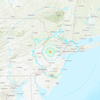
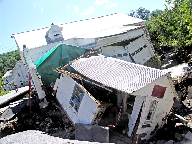
Flood damages: New maps from the Federal Emergency Management Agency, drawn up as part of the National Flood Insurance Program, require properties in flood zones to purchase flood insurance or increase the premiums on the flood insurance policies they already have.
ALBANY COUNTY — As of April 1, new regulations are in effect for areas determined by a national program to be in a floodplain.
The National Flood Insurance Program, administered by the Federal Emergency Management Agency —FEMA — is aimed at reducing the impact of flooding on private and public structures.
FEMA updated flood maps, with recommendations from the Technical Mapping Advisory Council, and encouraged communities to adopt and enforce floodplain management regulations based on the new maps.
Guilderland Supervisor Kenneth Runion said municipalities were given a standard flood law, from the state’s Department of Environmental Conservation, on which to model their own local laws.
Due to the remapping, some properties are now in special flood hazard areas, meaning they are required to either purchase flood insurance or the premiums for their current flood insurance will increase.
The maps provide information including data on river flow, storm tides, rainfall, and topographic surveys.
“Flood maps inform communities about local flood risks and set minimum floodplain standards for communities to build safely,” according to the National Flood Insurance Program informational website.
Guilderland’s local law for flood damage prevention states its purpose as promoting “the public health, safety, and general welfare, and to minimize public and private losses due to flood conditions in specific areas.”
It aims to minimize the expenditure of public money for flood-control projects; minimize the need for rescue and relief efforts associated with floods; notify developers that property is in an area of special flood hazard; and ensure that occupants of special flood hazard properties assume responsibility for their actions.
Companies or individuals planning construction or other development in areas of special flood hazard will have to obtain a permit, and standards for construction materials and methods, utilities, and elevation are set forth in the local law.
The National Flood Insurance Program was created by Congress in 1968. Before that time, people who lived in flood zones simply couldn’t get insurance and relied on federal relief if their homes or businesses flooded.
When the program was first introduced, homes that were built in areas prone to flooding were grandfathered in, and given flood insurance subsidies by the government.
There were revisions to the program in 1972 — requiring insurance from a federally regulated lender if property being purchased was in a flood zone — and 1994, adding penalties for lenders who didn’t comply.
As of September 2011, the National Flood Insurance Program was more than $20 billion in debt.
“The government decided there were so many catastrophic events, they couldn’t keep subsidizing things, and needed to increase the premiums,” said Neal Brady, a licensed insurance broker in Delmar. “They looked at how much was being spent on catastrophic events, how much they were spending, and how much they were taking in, and they just couldn’t continue.”
The remnants of Hurricane Irene in August of 2011 caused substantial damage in Albany County; the Weather Underground ranks it the seventh most costly in United States history at $15.8 billion. Tropical storm Lee followed in September of 2011.
In October of 2012, Hurricane Sandy hit New Jersey, affecting downstate New York. It is considered the second costliest hurricane in United States history at an estimate of $65 billion.
There is some grandfathering in with the newest maps and the National Flood Insurance Program, Brady said.
Premiums will increase for those living in newly-designated floodplains, but not more than 20 percent in a given year.
Homeowners can check to see whether the floodplain status for their property has changed by visiting https://msc.fema.gov/portal/search and entering an address and then contacting an insurance agent.
It is important to note, Brady said, that not all insurance agents are certified to participate in the National Flood Insurance Program. Some agents opt not to become certified for a variety of reasons, including the extra paperwork involved.
It is also important to realize that incidents of flooding covered by homeowners’ insurance are not the same as incidents of flooding covered by specific flood insurance.
For example, said Brady, rain coming in through a leaky roof does not qualify as a flooding event. The flooding covered by flood insurance must be caused by the ground-level water rising or another topographical change, such as a mudslide.
Richard C. Reilly, attorney for Voorheesville, said most of the changes in the village are along the Vly Creek, where much of the area adjacent to the waterway has been declared “subject to inundation by the 1-percent annual chance flood, also known as the “100-year flood.”
Other local areas declared subject to flooding include property along the Vlomankill, Normanskill, Hungerkill, Bozenkill, Switzkill, a tributary to Warners Lake, a tributary to Thompsons Lake, a tributary to Myositis Lake, Basic Creek Reservoir, and Ten Mile Creek.